Relying on basic city mapping apps when you are heading deep into the backcountry, tackling a brutal mountain ridge, or running a tactical field operation is a surefire way to end up in serious trouble. You need a hardcore navigation tool built for people who actually touch grass. Whether you are a hardcore hunter, a serious mountaineer, a military professional, or an avid geocacher, Mgrs & Utm Map Pro is an absolute powerhouse of an app that turns your mobile device into a professional grade grid reader.
ENDLESS MAP STYLES FOR EVERY TERRAIN
Standard maps give you one boring view and call it a day.
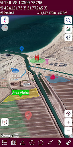
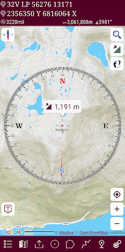
This app completely shatters those limitations by handing you access to an incredible variety of specialized mapping styles. Switch effortlessly between topographic layouts, cycling routes, neighborhood views, and massive atlas layers. Whether you are pushing through dense, tangled forests, scaling rocky alpine peaks, or navigating wide open desert plains, you get the exact visual terrain data you need to plan your route and scout new locations like a seasoned explorer.
ALTITUDE PROFILE CHARTS FOR SERIOUS CLIMBS
Guessing how much energy a hike is going to drain out of you is a rookie mistake.
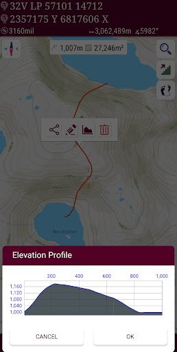
The built in altitude profile chart gives you an instant, visual breakdown of your route’s elevation changes. If you are trekking or mountaineering, being able to monitor your exact climb fluctuations helps you pace yourself and organize your gear before your legs turn to jelly. It gives you a crystal clear understanding of the landscape’s physical demands right on your screen.
SEAMLESS ADDRESS SEARCH AND CUSTOM LAYERS
Wandering around trying to pinpoint a specific coordinate manually can be painfully slow when you are on the move.
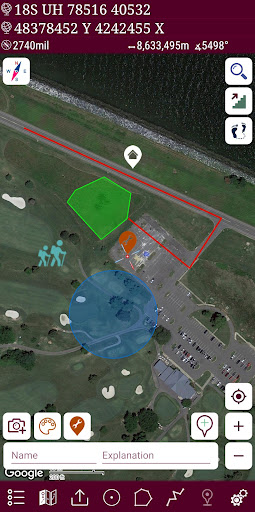
You can run fast, address based searches to snap directly to your target location without endlessly pinching and zooming across the map. Once you are there, the smart layer management system lets you organize your entire trip. Group your routes by specific activities, separating your hunting spots, fishing holes, and hiking trails into distinct, easy to manage layers that keep your interface clean and uncluttered.
ADVANCED MARKER MANAGEMENT AND KML SUPPORT
Keeping track of dozens of custom waypoints shouldn’t feel like organizing a messy filing cabinet.
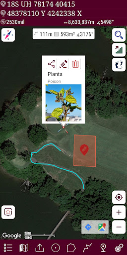
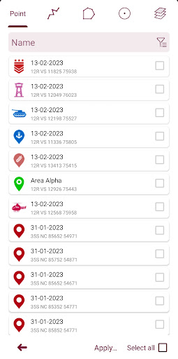
The app features a robust list view for all your areas, markers, routes, and imported KML files. You can easily measure distances, calculate area sizes, add custom names, and color code your pointer icons so your map stays visually organized. Sticking a bright, distinctive icon on a critical waypoint means you will never miss your marker when the weather turns rough or the sun goes down.
BUILT IN GPS RECORDER AND ZERO ADS
Tracking your athletic progress or reviewing a completed tactical route is vital for long term improvement.
The native GPS recorder tracks your movements seamlessly, letting you evaluate your speed, assess your efficacy over time, and set new outdoor goals.
The absolute best part? There are zero ads. No annoying pop ups blocking your screen when you are trying to check your coordinates. You get a completely uninterrupted, hyper focused navigation experience that lets you keep your head in the game and your eyes on the trail.